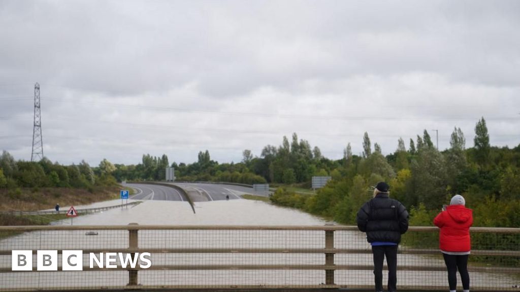
Drier and cooler weather after flooding in England and Wales

Drier but cooler conditions are forecast widely for parts of the UK battered by recent heavy rain and flooding.
Scotland will see some heavy showers and possible thunder, extending later to parts of northern England, but this will be isolated and localised while further weather warnings are “unlikely”, the Met Office said.
Parts of central and southern England experienced a month’s worth of rain in a matter of hours, leading to widespread travel disruption and damage to properties.
Flooding in Bedfordshire was among the most severe, including along the A421 road, which National Highways said would probably remain closed on Tuesday in both directions between Bedford and Marston Moretaine.
It added that it could not “provide a timeline for the road to reopen”.
Woburn in Bedfordshire had its wettest day on record with 132mm (5.2 inches) of rainfall recorded in 48 hours, more than double the September average, the Met Office said.
Many parts of Oxfordshire, Warwickshire and Northamptonshire also saw more than 100mm of rain over the same period.
The Environment Agency issued more than 35 flood warnings, meaning flooding was expected, and more than 90 flood alerts, meaning flooding was possible.
Liam Eslick, meteorologist at the Met Office, said Tuesday would be a “much drier day for most people”.
There may be heavier bursts of rain in the South East, with some light, isolated showers, though “nothing like the torrential rain that we’ve seen over the last couple of days”, he added.
Mr Eslick said the heaviest rain on Tuesday would be in and around Scotland, with any surface water flooding on roads very localised.
River levels should start to decrease to more manageable levels elsewhere towards the end of the day as more water seeps into the ground.
Temperatures will also begin to drop, bringing a “fresher feel” compared to recent days, Mr Eslick said.
Highs of around 16C are forecast for southern England, while parts of Scotland will peak at 11C.
“As the system that we have had moves its way off towards the east, we start to get a bit more of a northerly flow so we’re bringing in those cooler northerly winds,” the forecaster said.
A gradual decline in temperatures will continue through Wednesday and Thursday but it is unlikely any frost will develop with plenty of cloud around.
World News || Latest News || U.S. News
Source link


